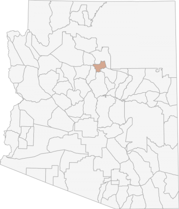
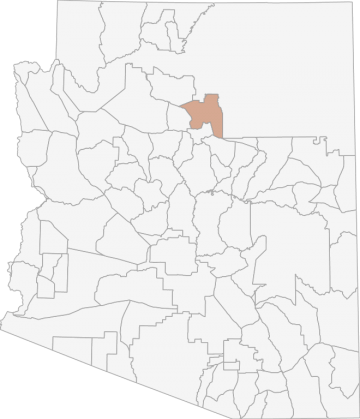
All Hunting in Arizona Game Management Unit 11M
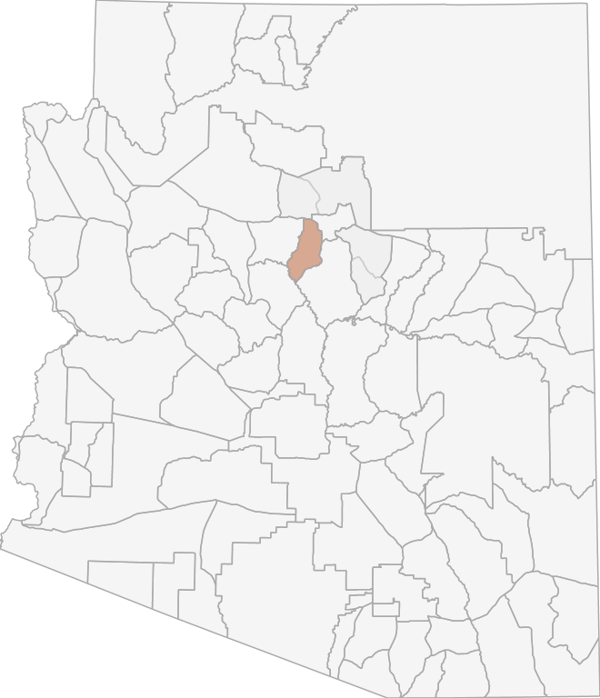
The elevation in this area ranges from 4,200' to 12,633'. Great Basin desert scrub persists at the lowest elevations in the northeastern corner of the unit. Open grassland and pinion-juniper woodlands occur at about a 1:2 ratio at elevations below the po
Scores
Access Notes
With A Free Account Get:
- All Access Information
- Satallite and Topo Layers
- Public Landownership Layers
- Roads and Trails Layers
- Burn Layers
- Water Tank Layer (AZ Only)
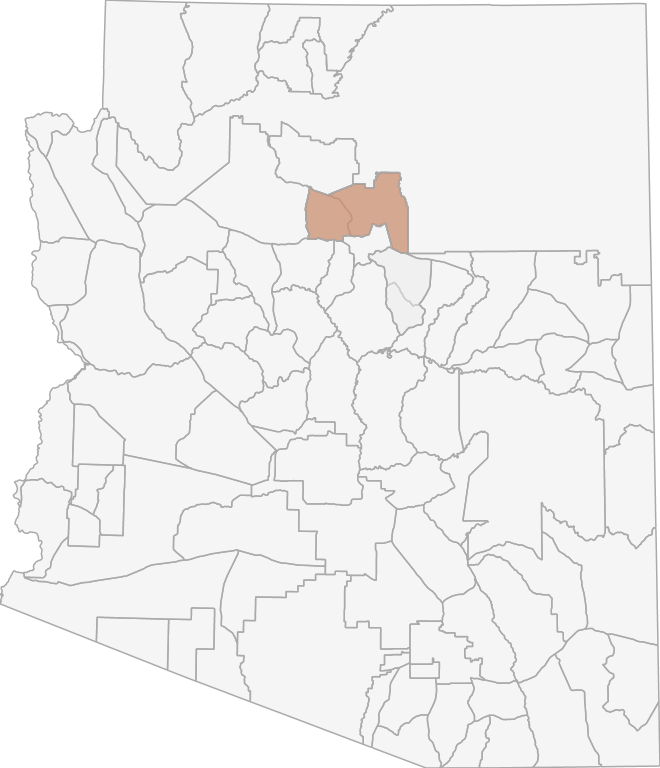
Beginning at the junction of Lake Mary-ClintÕs Well Rd. (FH3) and Walnut Canyon (mp 337.5 on FH3); northeasterly along Walnut Canyon to the Walnut Canyon National Monument boundary; northeasterly along the northern boundary of the Walnut Canyon National Monument to Walnut Canyon; northeasterly along Walnut Canyon to I-40 (mp 210.2); east on I-40 to the 345 KV transmission lines 1 and 2 (mp 212 on I-40); north and northeasterly along the power line to FR 545 (Sunset Crater Rd.); west along FR 545 to the Sunset Crater National Monument boundary; westerly along the southern boundary of the Sunset Crater National Monument to FR 545; west on FR 545 to U.S. Hwy 89; across U.S. Hwy 89 to FR 420 (Schultz Pass Rd.); southwesterly on FR 420. to the Transwestern Gas Pipeline; westerly along the Transwestern Gas Pipeline to FR 171; south on FR 171 to I-40 (mp 184.4 on I-40); east on I-40 to a point just north of the eastern boundary of Camp Navajo (mp 188.5 on I-40); south along the eastern boundary of Camp Navajo to the southeast corner of Camp Navajo; southeast approximately 1/3 mile to the forest road in section 33; southeasterly along the forest road to FR 231 (Woody Mountain Rd.); easterly on FR 231 to FR 533; southerly on FR 533 to U.S. Hwy 89A; southerly on U.S. Hwy 89A to FR 237; northeasterly on FR 237 to Mountainaire Rd.; easterly on Mountainaire Rd. to FR 700; southerly on FR 700 to FR 235K; southeasterly on FR 235K to FR 235; northerly on FR 235 to FR 235A; easterly on FR 235A to FR 235; easterly on FR 235 to Priest Draw; northeasterly along the bottom of Priest Draw to FR 235; easterly on FR 235 to FR 132; southeasterly on FR 132 to FR 296A; northeasterly on FR 296A to FR 296; northeasterly on FR 296 to FR 132; northeasterly on FR 132 to FH3; southeasterly on FH3 to Walnut Canyon (mp 337.5 on FH3).
All Notes
With A Free Account Get:
- Toggle between terrain, satellite, and topographic views
- Additional species-specific map layers
- Full screen maps
- Complete species hunting information
HuntScore Tip
Selection of a good area is one step to improving your success. You must be able to locate deer and familiarize yourself with their habitats. Use of good optics and some pre-season scouting will increase your odds of being successful.
State Agency Website
Visit Arizona Game and Fish DepartmentBusinesses Serving All Hunters In Game Management Unit 11M
Advertise Your Business!

Category: Guide/Outfitter
: 555-555-5555
About
Are you an outfitter, hunting guide, game processor or local hotel? Do you have landowner tags, lease land, or have an lodge? Advertise on HuntScore and reach hunters interested in this hunting unit! Send us an email at [email protected] to learn more. Read about advertising on huntscore here
Photos and Terrain Notes
The elevation in this area ranges from 4,200' to 12,633'. Great Basin desert scrub persists at the lowest elevations in the northeastern corner of the unit. Open grassland and pinion-juniper woodl... Create a free account to read the rest of this terrain note!
All Harvest Stats (2020)
| Manner | Season | Type | Sex | Hunters | Harvest | Male | Female | Youth |
|---|---|---|---|---|---|---|---|---|
|
F
|
|
N/A | 0 | 0 |
0
|
0
|
0
|
|
|
|
N/A | 0 | 2 |
1
|
0
|
0
|
||
|
S
|
|
N/A | 0 | 0 |
0
|
0
|
0
|
|
|
A
|
A
|
LL
|
E
|
118 | 37 |
37
|
0
|
0
|
|
A
|
A
|
LL
|
E
|
42 | 17 |
17
|
0
|
0
|
|
A
|
A
|
LL
|
F
|
80 | 30 |
0
|
30
|
0
|
|
A
|
A
|
LL
|
F
|
72 | 18 |
0
|
18
|
0
|
|
A
|
A
|
LL
|
M
|
4 | 1 |
0
|
0
|
0
|
|
A
|
A
|
LL
|
M
|
75 | 29 |
29
|
0
|
0
|
|
A
|
A
|
LL
|
M
|
77 | 25 |
25
|
0
|
0
|
Go Pro and get:
- Most up to date data!
- Harvest trends across multiple years
- Harvest stats by hunt_code, manner, season, sex, type
- Average harvest rates
- Average days per hunter
- Overall harvest trends
See all stats but the last 2 years with a free account!
Weather Insights
Weather can vary by elevation. See how weather varies by elevation within a unit by selecting an elevation range. Elevation ranges are based on weather stations in or near the unit. Not all weather elements are available within the unit.
Average Temps
Use temperature ranges to plan and prepare for your hunt. Large swings indicate a good layering system should be used. Be sure to make note of the extreme temperatures as these often pose the greatest risk to hunters. If you plan on hunting in higher elevation, as a rule of thumb, expect the tempture to decrease roughly 5° for every 1000' in elevation gain.
WITH A FREE ACCOUNT GET:
- Precip totals by month
- Snow depth by month
- Min/Max precip and snow depth
- Average # of days between precip or snow event
- Wind speed and wind direction by month
- Sunshine and cloud cover stats by month
- Probability of other weather events (thunder, hail, etc...) by by month
Similar Nearby All Units
TrailHead Chatter
With A Free Account Get:
- Ability to read comments
- Ability to post comments
- Ability to upvote and downvote comments