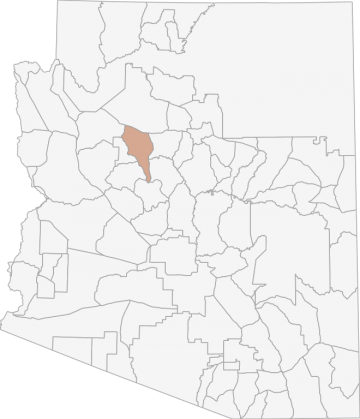
All Hunting in Arizona Game Management Unit 19B
The unit is characterized by high desert grassland valleys which are bordered by pinyon-juniper covered mesas. The elevation in this area ranges from 4,360' where Big Chino Wash becomes the Verde River headwaters to 7,168' on Picacho Butte. Access to the
Scores
Access Notes
With A Free Account Get:
- All Access Information
- Satallite and Topo Layers
- Public Landownership Layers
- Roads and Trails Layers
- Burn Layers
- Water Tank Layer (AZ Only)
Beginning at the intersection of U.S. Hwy 89 and AZ Hwy 69, west on Gurley St. to Grove Ave.; north on the Grove Ave. to Miller Valley Rd.; northwest on the Miller Valley Rd. to Iron Springs Rd.; northwest on the Iron Springs Rd. to the junction of Williamson Valley Rd. and Iron Springs Rd.; northerly on the Williamson Valley-Prescott-Seligman Rd. (FR 6, Williamson Valley Rd.) to AZ Hwy 66 at Seligman; east on Crookton Rd. (AZ Hwy 66) to I-40 (Exit 139); east on I-40 to U.S. Hwy 89; south on U.S. Hwy 89 to the junction with AZ Hwy 69; except those portions that are sovereign tribal lands of the Yavapai-Prescott Tribe.
Most of the private property associated with the Big Chino Valley (from Paulden to Seligman) has been closed to public access. Other private property near Picacho Butte has been closed to public ac... Create a free account to read the rest of this access note!
All Notes
With A Free Account Get:
- Toggle between terrain, satellite, and topographic views
- Additional species-specific map layers
- Full screen maps
- Complete species hunting information
HuntScore Tip
The quality of your hunt depends on you. Preseason scouting, preparation for the environmental conditions, and physical conditioning are important factors. The success and quality of your hunt will likely increase with the distance from your vehicle and roads.
State Agency Website
Visit Arizona Game and Fish DepartmentBusinesses Serving All Hunters In Game Management Unit 19B
Advertise Your Business!

Category: Guide/Outfitter
: 555-555-5555
About
Are you an outfitter, hunting guide, game processor or local hotel? Do you have landowner tags, lease land, or have an lodge? Advertise on HuntScore and reach hunters interested in this hunting unit! Send us an email at [email protected] to learn more. Read about advertising on huntscore here
Photos and Terrain Notes
The unit is characterized by high desert grassland valleys which are bordered by pinyon-juniper covered mesas. The elevation in this area ranges from 4,360' where Big Chino Wash becomes the Verde ... Create a free account to read the rest of this terrain note!
All Drawing Stats (2023)
1st Choice Draw Odds
| Stats | Apply For | Sex | Manner | Season | Type | Draw Odds | HuntScore | Notes |
|---|---|---|---|---|---|---|---|---|
| 19B_J_1_E_A_S_LL |
E
|
A
|
S
|
LL
|
99%
|
0 | 2023 Hunt Code: 5084 | |
| 19B_J_1_E_HAM_S_LL |
E
|
HAM
|
S
|
LL
|
100%
|
0 | 2023 Hunt Code: 5056 | |
| 19B_J_1_E_ALL_S_Y |
E
|
ALL
|
S
|
Y
|
91.1%
|
0 | 2023 Hunt Code: 5035 | |
| 19B_J_1_E_ALL_S_LL |
E
|
ALL
|
S
|
LL
|
100%
|
0 | 2023 Hunt Code: 5007 |
Go Pro and get:
- Most up to date data!
- Drawing trends across multiple years
- Individual hunt quotas
- 1st choice license applications and licenses drawn
- Draw odds for resident and nonresident applicants
- Minimum preference points to draw
- Point creep plots
See all stats but the last 2 years with a free account!
All Harvest Stats (2021)
| Manner | Season | Type | Sex | Hunters | Harvest | Male | Female | Youth |
|---|---|---|---|---|---|---|---|---|
|
A
|
S
|
LL
|
E
|
1303 | 0 |
0
|
0
|
0
|
|
ALL
|
S
|
LL
|
E
|
197 | 0 |
0
|
0
|
0
|
|
ALL
|
S
|
Y
|
E
|
115 | 0 |
0
|
0
|
0
|
|
HAM
|
S
|
LL
|
E
|
88 | 0 |
0
|
0
|
0
|
Go Pro and get:
- Most up to date data!
- Harvest trends across multiple years
- Harvest stats by hunt_code, manner, season, sex, type
- Average harvest rates
- Average days per hunter
- Overall harvest trends
See all stats but the last 2 years with a free account!
Weather Insights
Weather can vary by elevation. See how weather varies by elevation within a unit by selecting an elevation range. Elevation ranges are based on weather stations in or near the unit. Not all weather elements are available within the unit.
Average Temps
Use temperature ranges to plan and prepare for your hunt. Large swings indicate a good layering system should be used. Be sure to make note of the extreme temperatures as these often pose the greatest risk to hunters. If you plan on hunting in higher elevation, as a rule of thumb, expect the tempture to decrease roughly 5° for every 1000' in elevation gain.
WITH A FREE ACCOUNT GET:
- Precip totals by month
- Snow depth by month
- Min/Max precip and snow depth
- Average # of days between precip or snow event
- Wind speed and wind direction by month
- Sunshine and cloud cover stats by month
- Probability of other weather events (thunder, hail, etc...) by by month
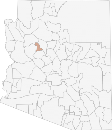
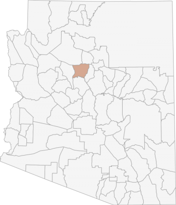
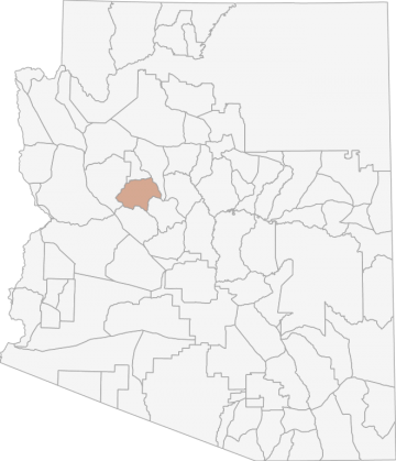
Similar Nearby All Units
TrailHead Chatter
With A Free Account Get:
- Ability to read comments
- Ability to post comments
- Ability to upvote and downvote comments