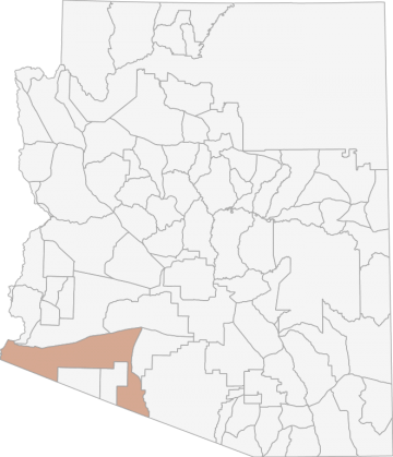
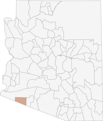
All Hunting in Arizona Game Management Unit 40B
The elevation in this area ranges from approximately 200' to 3200'. Terrain consists of broad alluvial valleys and low rolling slopes cut by large desert washes. North/south running mountain ranges composed of granite and volcanic rock rise abruptly from
Scores
Access Notes
With A Free Account Get:
- All Access Information
- Satallite and Topo Layers
- Public Landownership Layers
- Roads and Trails Layers
- Burn Layers
- Water Tank Layer (AZ Only)
Beginning at Gila Bend; westerly on I-8 to the Colorado River; southerly along the Colorado River to the Mexican border at San Luis; southeasterly along the border to the Cabeza Prieta National Wildlife Refuge; northerly, easterly and southerly around the refuge boundary to the Mexican border; southeast along the border to the Tohono OÕodham (Papago) Indian Reservation; northerly along the reservation boundary to AZ Hwy 86; northwesterly on AZ Hwy 86 to AZ Hwy 85; north on AZ Hwy 85 to Gila Bend; except those portions that are sovereign tribal lands of the Cocopah Tribe.
A large portion of Unit 40B is located within the Barry M. Goldwater Range (BMGR). To access the BMGR, individuals are required to sign a hold harmless agreement and obtain a range access permit go... Create a free account to read the rest of this access note!
All Notes
With A Free Account Get:
- Toggle between terrain, satellite, and topographic views
- Additional species-specific map layers
- Full screen maps
- Complete species hunting information
HuntScore Tip
Pronghorn hunting throughout Arizona is becoming more restrictive since many of the populations are located on or near private lands. This requires the hunter to adhere to restrictions that are not found on public lands.
State Agency Website
Visit Arizona Game and Fish DepartmentBusinesses Serving All Hunters In Game Management Unit 40B
Advertise Your Business!

Category: Guide/Outfitter
: 555-555-5555
About
Are you an outfitter, hunting guide, game processor or local hotel? Do you have landowner tags, lease land, or have an lodge? Advertise on HuntScore and reach hunters interested in this hunting unit! Send us an email at [email protected] to learn more. Read about advertising on huntscore here
Photos and Terrain Notes
The elevation in this area ranges from approximately 200' to 3200'. Terrain consists of broad alluvial valleys and low rolling slopes cut by large desert washes. North/south running mountain range... Create a free account to read the rest of this terrain note!
All Harvest Stats (2020)
| Manner | Season | Type | Sex | Hunters | Harvest | Male | Female | Youth |
|---|---|---|---|---|---|---|---|---|
|
|
N/A | 0 | 1 |
0
|
0
|
0
|
||
|
ALL
|
G
|
LL
|
E
|
418 | 148 |
148
|
0
|
0
|
|
ALL
|
G
|
LL
|
M
|
4 | 4 |
0
|
0
|
0
|
|
ALL
|
G
|
LL
|
M
|
2 | 2 |
0
|
0
|
0
|
|
ALL
|
G
|
LL
|
M
|
2 | 2 |
0
|
0
|
0
|
|
M
|
M
|
LL
|
E
|
46 | 23 |
23
|
0
|
0
|
Go Pro and get:
- Most up to date data!
- Harvest trends across multiple years
- Harvest stats by hunt_code, manner, season, sex, type
- Average harvest rates
- Average days per hunter
- Overall harvest trends
See all stats but the last 2 years with a free account!
Weather Insights
Weather can vary by elevation. See how weather varies by elevation within a unit by selecting an elevation range. Elevation ranges are based on weather stations in or near the unit. Not all weather elements are available within the unit.
Average Temps
Use temperature ranges to plan and prepare for your hunt. Large swings indicate a good layering system should be used. Be sure to make note of the extreme temperatures as these often pose the greatest risk to hunters. If you plan on hunting in higher elevation, as a rule of thumb, expect the tempture to decrease roughly 5° for every 1000' in elevation gain.
WITH A FREE ACCOUNT GET:
- Precip totals by month
- Snow depth by month
- Min/Max precip and snow depth
- Average # of days between precip or snow event
- Wind speed and wind direction by month
- Sunshine and cloud cover stats by month
- Probability of other weather events (thunder, hail, etc...) by by month
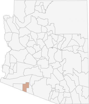
Similar Nearby All Units

TrailHead Chatter
With A Free Account Get:
- Ability to read comments
- Ability to post comments
- Ability to upvote and downvote comments