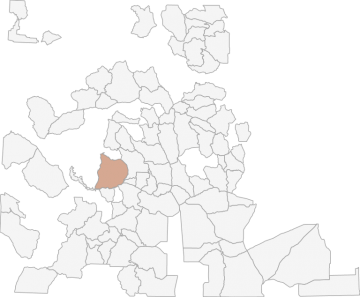
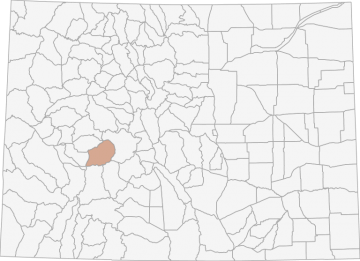
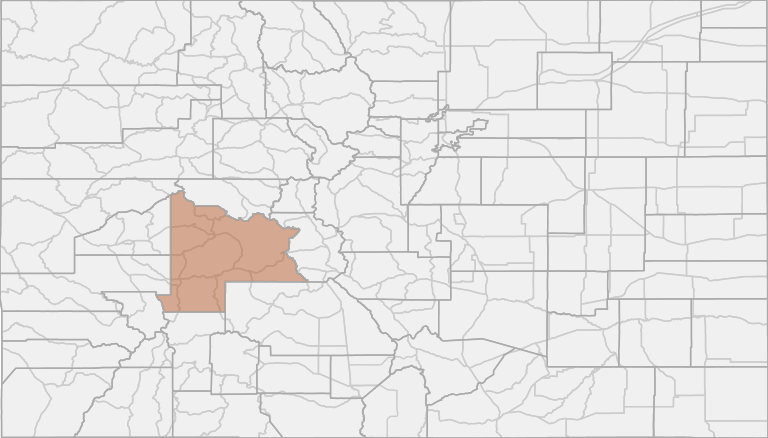
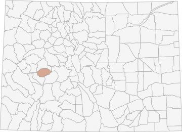
All Hunting in Colorado GMU S54 - Dillon Mesa
Bounded on N by County Road 12; on E by Colorado Highway 135; on S by US Highway 50, the Gunnison River, Blue Mesa Reservoir and Colorado Highway 92; and on W by Curecanti Creek, Curecanti Pass and Coal Creek.
Scores
Access Notes
With A Free Account Get:
- All Access Information
- Satallite and Topo Layers
- Public Landownership Layers
- Roads and Trails Layers
- Burn Layers
- Water Tank Layer (AZ Only)
Bounded on N by County Road 12; on E by Colorado Highway 135; on S by US Highway 50, the Gunnison River, Blue Mesa Reservoir and Colorado Highway 92; and on W by Curecanti Creek, Curecanti Pass and Coal Creek.
All Notes
With A Free Account Get:
- Toggle between terrain, satellite, and topographic views
- Additional species-specific map layers
- Full screen maps
- Complete species hunting information
HuntScore Tip
Many units in pronghorn country are located on private land. However, many have been rated as good access locations. Landowners are more likely to give you permission to hunt pronghorn than deer.
State Agency Website
Visit Colorado Parks and WildlifeBusinesses Serving All Hunters In GMU S54 - Dillon Mesa
Advertise Your Business!

Category: Guide/Outfitter
: 555-555-5555
About
Are you an outfitter, hunting guide, game processor or local hotel? Do you have landowner tags, lease land, or have an lodge? Advertise on HuntScore and reach hunters interested in this hunting unit! Send us an email at [email protected] to learn more. Read about advertising on huntscore here
Photos and Terrain Notes
All Harvest Stats (2022)
| Manner | Season | Type | Sex | Hunters | Harvest | Male | Female | Youth |
|---|---|---|---|---|---|---|---|---|
|
ALL
|
LL
|
N/A | 5 | 3 |
3
|
0
|
0
|
|
|
A
|
O1
|
LL
|
N/A | 1 | 1 |
1
|
0
|
0
|
|
R
|
O1
|
LL
|
N/A | 4 | 2 |
2
|
0
|
0
|
Go Pro and get:
- Most up to date data!
- Harvest trends across multiple years
- Harvest stats by hunt_code, manner, season, sex, type
- Average harvest rates
- Average days per hunter
- Overall harvest trends
See all stats but the last 2 years with a free account!
Similar Nearby All Units
TrailHead Chatter
With A Free Account Get:
- Ability to read comments
- Ability to post comments
- Ability to upvote and downvote comments