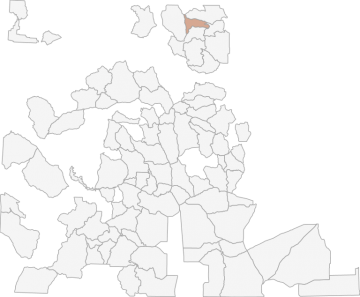
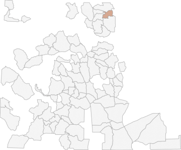
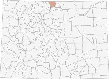
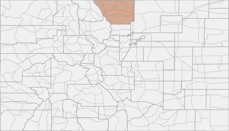
All Hunting in Colorado GMU S1 - Poudre River
The overall climate in this area is relatively dry with low humidity. Climate varies across the DAU as a function of elevation. Conditions on the eastern edge of S40 are standard for the foothills/short grass prairie interface, with relatively mild winter
Scores
Access Notes
With A Free Account Get:
- All Access Information
- Satallite and Topo Layers
- Public Landownership Layers
- Roads and Trails Layers
- Burn Layers
- Water Tank Layer (AZ Only)
Bounded on N by County Road 80C and Deadman-Red Feather Road; on E by County Road 68C (Boy Scout Ranch Road) and Elkhorn Creek; on S by Colorado Highway 14; and on W by the Laramie River Road.
All Notes
With A Free Account Get:
- Toggle between terrain, satellite, and topographic views
- Additional species-specific map layers
- Full screen maps
- Complete species hunting information
HuntScore Tip
Public land and private land percentages can sometime be misleading. A unit may have 80% public land, but a particluar species may only occupy 20% on the entire area. And that 20% species distribution may lie 100% within private lands. Does that sound confusing? Just remember that there are always exceptions to the rule, and land ownership is just one piece of the puzzle.
State Agency Website
Visit Colorado Parks and WildlifeBusinesses Serving All Hunters In GMU S1 - Poudre River
Advertise Your Business!

Category: Guide/Outfitter
: 555-555-5555
About
Are you an outfitter, hunting guide, game processor or local hotel? Do you have landowner tags, lease land, or have an lodge? Advertise on HuntScore and reach hunters interested in this hunting unit! Send us an email at [email protected] to learn more. Read about advertising on huntscore here
Photos and Terrain Notes
The overall climate in this area is relatively dry with low humidity. Climate varies across the DAU as a function of elevation. Conditions on the eastern edge of S40 are standard for the foothills/... Create a free account to read the rest of this terrain note!
All Harvest Stats (2022)
| Manner | Season | Type | Sex | Hunters | Harvest | Male | Female | Youth |
|---|---|---|---|---|---|---|---|---|
|
ALL
|
LL
|
N/A | 3 | 1 |
0
|
1
|
0
|
|
|
R
|
O1
|
LL
|
N/A | 1 | 1 |
0
|
1
|
0
|
|
R
|
O2
|
LL
|
N/A | 2 | 0 |
0
|
0
|
0
|
Go Pro and get:
- Most up to date data!
- Harvest trends across multiple years
- Harvest stats by hunt_code, manner, season, sex, type
- Average harvest rates
- Average days per hunter
- Overall harvest trends
See all stats but the last 2 years with a free account!
Similar Nearby All Units
TrailHead Chatter
With A Free Account Get:
- Ability to read comments
- Ability to post comments
- Ability to upvote and downvote comments