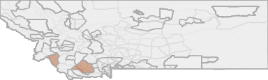
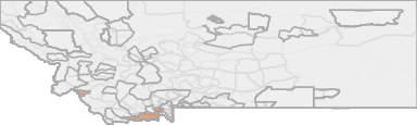
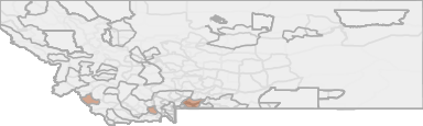
All Hunting in Montana HD 321 - West Big Hole
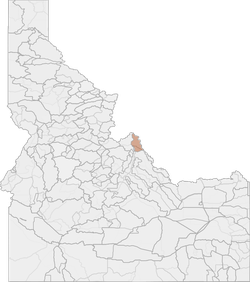
The 1,985-square-mile Sapphire EMU includes the Sapphire Mountains between the Bitterroot River and Rock Creek and the north and west parts of the upper Big Hole Valley.
Scores
Access Notes
With A Free Account Get:
- All Access Information
- Satallite and Topo Layers
- Public Landownership Layers
- Roads and Trails Layers
- Burn Layers
- Water Tank Layer (AZ Only)
That portion of Beaverhead County lying within the following-described boundary: Beginning at Wisdom and Route 278, then southerly along said route to the JacksonSkinner Meadows Road, then southerly along said road to the Big Hole-Bloody Dick Divide, then westerly along said divide to the Montana-Idaho border and Continental Divide, then northerly along said divide to Route 43, then easterly along said route to Route 278 at Wisdom, the point of beginning.
The major portion of this elk management unit is moderately roaded, offering good public access. The northern half of hunting district (HD) 270 is heavily roaded and contains many ?loop? roads. Thi... Create a free account to read the rest of this access note!
All Notes
With A Free Account Get:
- Toggle between terrain, satellite, and topographic views
- Additional species-specific map layers
- Full screen maps
- Complete species hunting information
The 1,985-square-mile Sapphire EMU includes the Sapphire Mountains between the Bitterroot River and Rock Creek and the north and west parts of the upper Big Hole Valley. It also includes the draina... Create a free account to read the rest of this hunting note!
HuntScore Tip
The quality of your hunt depends on you. Preseason scouting, preparation for the environmental conditions, and physical conditioning are important factors. The success and quality of your hunt will likely increase with the distance from your vehicle and roads.
State Agency Website
Visit Montana Fish, Wildlife & ParksBusinesses Serving All Hunters In HD 321 - West Big Hole
Advertise Your Business!

Category: Guide/Outfitter
: 555-555-5555
About
Are you an outfitter, hunting guide, game processor or local hotel? Do you have landowner tags, lease land, or have an lodge? Advertise on HuntScore and reach hunters interested in this hunting unit! Send us an email at [email protected] to learn more. Read about advertising on huntscore here
Photos and Terrain Notes
Weather Insights
Weather can vary by elevation. See how weather varies by elevation within a unit by selecting an elevation range. Elevation ranges are based on weather stations in or near the unit. Not all weather elements are available within the unit.
Average Temps
Use temperature ranges to plan and prepare for your hunt. Large swings indicate a good layering system should be used. Be sure to make note of the extreme temperatures as these often pose the greatest risk to hunters. If you plan on hunting in higher elevation, as a rule of thumb, expect the tempture to decrease roughly 5° for every 1000' in elevation gain.
WITH A FREE ACCOUNT GET:
- Precip totals by month
- Snow depth by month
- Min/Max precip and snow depth
- Average # of days between precip or snow event
- Wind speed and wind direction by month
- Sunshine and cloud cover stats by month
- Probability of other weather events (thunder, hail, etc...) by by month
Similar Nearby All Units
TrailHead Chatter
With A Free Account Get:
- Ability to read comments
- Ability to post comments
- Ability to upvote and downvote comments