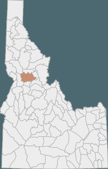
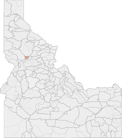
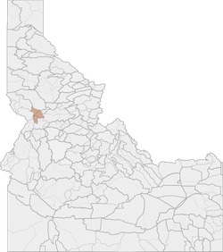
Elk Hunting in Idaho Unit 15 - Elk City Elk Zone - Clearwater Region - Region 2
Forest make up 96% of the land cover in this unit
Scores
Access Notes
With A Free Account Get:
- All Access Information
- Satallite and Topo Layers
- Public Landownership Layers
- Roads and Trails Layers
- Burn Layers
- Water Tank Layer (AZ Only)
That portion of Idaho County within the following boundary: beginning at Grangeville on State Highway 13, then northeast on State Highway 13 to the South Fork of the Clearwater River, then downstream to the road that goes up Sally Ann Creek, then up the road to the town of Clearwater, then southeast along Forest Service Road 284 to Forest Service Road 464, then east along Forest Service Road 464 to the Falls Point Road (Forest Service Road 443), then south on the Falls Point Road to Forest Service Trail 835, then southeast along Forest Service Trail 835 to Anderson Butte, then south over Forest Service Trail 505 to Black Hawk Mountain and Soda Creek Point to the Montana Road (Forest Service Road 468), then west on Montana Road to the Red River Ranger Station- Mackay Bar Road (Forest Service Road 222.3), then southwest on Red River Ranger Station-Mackay Bar Road to Dixie Summit, then west along the watershed divide between the South Fork Clearwater and Salmon Rivers over the Crooked River-Big Creek Divide, Orogrande Summit and Square Mountain to the Moores Guard Station-Adams Ranger Station Road (Forest Service Road 444), then west on Moores Guard Station-Adams Ranger Station Road to the Grangeville-Salmon River Road (Forest Service Road 221), then north on GrangevilleSalmon River Road to Grangeville, the point of beginning.
Elk Notes
With A Free Account Get:
- Toggle between terrain, satellite, and topographic views
- Additional species-specific map layers
- Full screen maps
- Complete species hunting information
HuntScore Tip
The quality of your hunt depends on you. Preseason scouting, preparation for the environmental conditions, and physical conditioning are important factors. The success and quality of your hunt will likely increase with the distance from your vehicle and roads.
Management Plan
State Agency Website
Visit Idaho Fish and GameBusinesses Serving Elk Hunters In Unit 15 - Elk City Elk Zone - Clearwater Region - Region 2
Advertise Your Business!

Category: Guide/Outfitter
: 555-555-5555
About
Are you an outfitter, hunting guide, game processor or local hotel? Do you have landowner tags, lease land, or have an lodge? Advertise on HuntScore and reach hunters interested in this hunting unit! Send us an email at [email protected] to learn more. Read about advertising on huntscore here
Photos and Terrain Notes
Forest make up 96% of the land cover in this unit
... Create a free account to read the rest of this terrain note!Similar Nearby Elk Units

TrailHead Chatter
With A Free Account Get:
- Ability to read comments
- Ability to post comments
- Ability to upvote and downvote comments