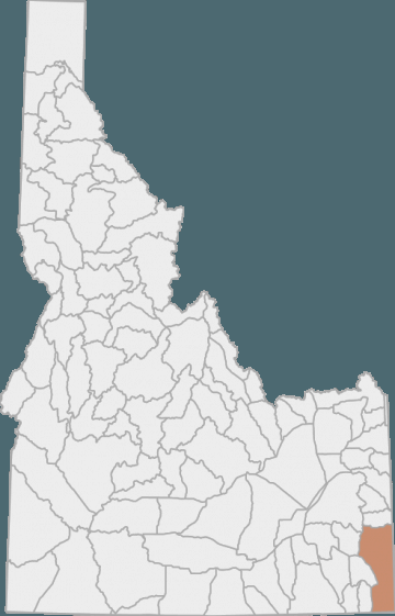
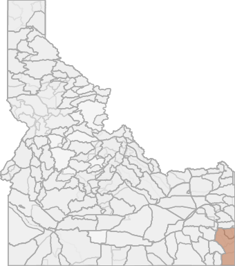
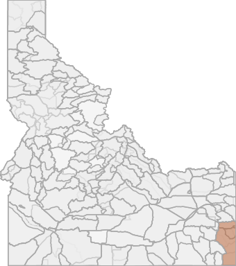
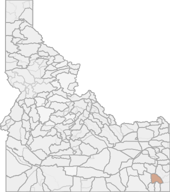
Elk Hunting in Idaho Unit 76 - Diamond Creek Elk Zone - Southeast Region - Region 5
The terrain in this unit is approximately 35% forest, 36% rangeland, 10% irrigated argriculture, and 11% dryland agriculture land.
Scores
Access Notes
With A Free Account Get:
- All Access Information
- Satallite and Topo Layers
- Public Landownership Layers
- Roads and Trails Layers
- Burn Layers
- Water Tank Layer (AZ Only)
Those portions of Bear Lake and Caribou counties within the following boundary: beginning at U.S. 89 on the Idaho Utah State line, then north to Montpelier, then north on U.S. 30 to Soda Springs, then northeast on State Highway 34 to the IdahoWyoming State line, then south on the Idaho-Wyoming State line to the Idaho-Utah State line, then west on the Idaho-Utah State line to U.S. 89, the point of beginning. 76-1
Moose
That portion of Unit 76 within the following boundary: Beginning at Soda Springs go north on State Highway 34 to Wayan, then south on the Wayan Loop Road, then south along the Lanes Creek-Diamond Creek Road to Timber Creek Road, then northeast along Timber Creek-Smoky Canyon-Stump Creek Road to the IdahoWyoming state line, then south along the state line to the Crow Creek Road, then southwest along Crow Creek-Wells Canyon-Georgetown Canyon Road to U.S. Highway 30, then north along U.S. Highway 30 to Soda Springs, the point of beginning. 76-2Moose
That portion of Unit 76 south of the GeorgetownWells Canyon-Crow Creek Road. 76-3Moose
That portion of Unit 76 north and east of the following boundary: Beginning at the Idaho-Wyoming state line, then west along the Stump Creek-Smoky Canyon-Timber Creek Road to the Diamond Creek Road, then north along the Diamond Creek-Lanes Creek Road to State Highway 34 at Wayan then east to the Idaho-Wyoming border.Elk Notes
With A Free Account Get:
- Toggle between terrain, satellite, and topographic views
- Additional species-specific map layers
- Full screen maps
- Complete species hunting information
HuntScore Tip
The quality of your hunt depends on you. Preseason scouting, preparation for the environmental conditions, and physical conditioning are important factors. The success and quality of your hunt will likely increase with the distance from your vehicle and roads.
Management Plan
State Agency Website
Visit Idaho Fish and GameBusinesses Serving Elk Hunters In Unit 76 - Diamond Creek Elk Zone - Southeast Region - Region 5
Advertise Your Business!

Category: Guide/Outfitter
: 555-555-5555
About
Are you an outfitter, hunting guide, game processor or local hotel? Do you have landowner tags, lease land, or have an lodge? Advertise on HuntScore and reach hunters interested in this hunting unit! Send us an email at [email protected] to learn more. Read about advertising on huntscore here
Photos and Terrain Notes
The terrain in this unit is approximately 35% forest, 36% rangeland, 10% irrigated argriculture, and 11% dryland agriculture land.
... Create a free account to read the rest of this terrain note!Similar Nearby Elk Units
TrailHead Chatter
With A Free Account Get:
- Ability to read comments
- Ability to post comments
- Ability to upvote and downvote comments