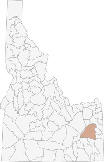
Gray Wolf Hunting in Idaho Unit 69 - Tex Creek Elk Zone - Upper Snake Region - Region 6
The terrain in this unit is approximately 42% rangeland, 12% forest, 5% irrigated agriculture, and 34% dryland agriculture land.
Scores
Access Notes
With A Free Account Get:
- All Access Information
- Satallite and Topo Layers
- Public Landownership Layers
- Roads and Trails Layers
- Burn Layers
- Water Tank Layer (AZ Only)
Those portions of Bingham, Bonneville, and Caribou counties within the following boundary: beginning at Idaho Falls, then south on U.S. 91 to Blackfoot, then south on Interstate 15 to the Fort Hall interchange, then east on the Fort Hall-Government Dam Road to the Blackfoot River below the Government Dam, then along the north and east shore of the Blackfoot River and Reservoir to State Highway 34, then north on State Highway 34 to the West Side Road, then north on the West Side Road west of Grays Lake to the Bone-Grays Lake Road, then east on the Bone-Grays Lake Road to Grays Lake Outlet, then downstream along the outlet to Brockman Creek, then up Brockman Creek to the Brockman Guard Station, then northwest on the Skyline Ridge Road (Forest Service Road 077) to Fall Creek Road (Forest Service Road 077), then east on the Fall Creek Road to the watershed divide between Fall and Tex Creeks, then north along the Fall Creek-Tex Creek, Antelope Creek-Pritchard Creek, Antelope Creek-Garden Creek and Garden Creek-Granite Creek watershed divides to the South Fork of the Snake River, then downstream along the mean high water line on the south shore of the South Fork to the Heise measuring cable (about 1.5 miles upstream from Heise Hot Springs), then southwest to U.S. 26, then west on U.S. 26 to Idaho Falls, the point of beginning. 69-1
Moose
That portion of Unit 69 west of the Grays LakeLong Valley-Bone-Iona Road. 69-2Moose
That portion of Unit 69 east of the Grays LakeLong Valley-Bone-Iona Road except the Antelope and Granite Creek drainages. 69-3Moose
That portion of Unit 69 within the Antelope and Granite Creek drainages, and that portion of Unit 66 within the Pritchard and Garden Creek drainages.Gray Wolf Notes
With A Free Account Get:
- Toggle between terrain, satellite, and topographic views
- Additional species-specific map layers
- Full screen maps
- Complete species hunting information
HuntScore Tip
The quality of your hunt depends on you. Preseason scouting, preparation for the environmental conditions, and physical conditioning are important factors. The success and quality of your hunt will likely increase with the distance from your vehicle and roads.
State Agency Website
Visit Idaho Fish and GameBusinesses Serving Gray-wolf Hunters In Unit 69 - Tex Creek Elk Zone - Upper Snake Region - Region 6
Advertise Your Business!

Category: Guide/Outfitter
: 555-555-5555
About
Are you an outfitter, hunting guide, game processor or local hotel? Do you have landowner tags, lease land, or have an lodge? Advertise on HuntScore and reach hunters interested in this hunting unit! Send us an email at [email protected] to learn more. Read about advertising on huntscore here
Photos and Terrain Notes
The terrain in this unit is approximately 42% rangeland, 12% forest, 5% irrigated agriculture, and 34% dryland agriculture land.
... Create a free account to read the rest of this terrain note!TrailHead Chatter
With A Free Account Get:
- Ability to read comments
- Ability to post comments
- Ability to upvote and downvote comments