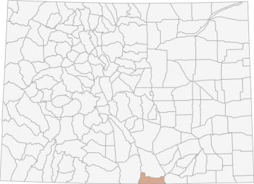
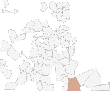
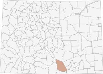
All Hunting in Colorado GMU 851 - Costilla and Las Animas Counties
The elevation in this area ranges from 14,000 feet on Culebra Peak to 6,025 feet near Trinidad. The terrain is Moderately steep and steep foothills to steep mountains. The vegetation consists of Grass to pine to spruce, firs and aspens to alpine meadow
Scores
Access Notes
With A Free Account Get:
- All Access Information
- Satallite and Topo Layers
- Public Landownership Layers
- Roads and Trails Layers
- Burn Layers
- Water Tank Layer (AZ Only)
Bounded on N by West and North for Kansas of Purgatoire River, County Highway 12; on E by I-25; on S by New Mexico; on W by Sangre deCristo Divide.
There is very little public land in 851. There is a small portion of USFS land available on north boundary. The only other major public portion of 851 for big game hunting is the Bosque del Oso SWA... Create a free account to read the rest of this access note!
All Notes
With A Free Account Get:
- Toggle between terrain, satellite, and topographic views
- Additional species-specific map layers
- Full screen maps
- Complete species hunting information
State Agency Website
Visit Colorado Parks and WildlifeBusinesses Serving All Hunters In GMU 851 - Costilla and Las Animas Counties
Advertise Your Business!

Category: Guide/Outfitter
: 555-555-5555
About
Are you an outfitter, hunting guide, game processor or local hotel? Do you have landowner tags, lease land, or have an lodge? Advertise on HuntScore and reach hunters interested in this hunting unit! Send us an email at [email protected] to learn more. Read about advertising on huntscore here
Photos and Terrain Notes
The elevation in this area ranges from 14,000 feet on Culebra Peak to 6,025 feet near Trinidad. The terrain is Moderately steep and steep foothills to steep mountains. The vegetation consists of ... Create a free account to read the rest of this terrain note!
Weather Insights
Weather can vary by elevation. See how weather varies by elevation within a unit by selecting an elevation range. Elevation ranges are based on weather stations in or near the unit. Not all weather elements are available within the unit.
Average Temps
Use temperature ranges to plan and prepare for your hunt. Large swings indicate a good layering system should be used. Be sure to make note of the extreme temperatures as these often pose the greatest risk to hunters. If you plan on hunting in higher elevation, as a rule of thumb, expect the tempture to decrease roughly 5° for every 1000' in elevation gain.
WITH A FREE ACCOUNT GET:
- Precip totals by month
- Snow depth by month
- Min/Max precip and snow depth
- Average # of days between precip or snow event
- Wind speed and wind direction by month
- Sunshine and cloud cover stats by month
- Probability of other weather events (thunder, hail, etc...) by by month
Similar Nearby All Units
TrailHead Chatter
With A Free Account Get:
- Ability to read comments
- Ability to post comments
- Ability to upvote and downvote comments