All Hunting in Wyoming Hunt Area 88 - Greys Feedground
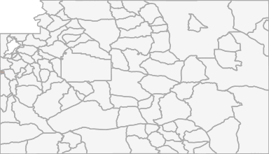
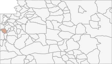
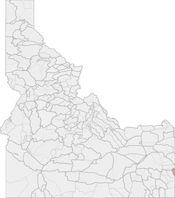
Beginning at the Wyoming-Idaho state line on the Snake River; easterly up said river to the Greys River; easterly up said river to the confluence of the Greys River and Squaw Creek; southwesterly from said confluence to the ridge between the Squaw Creek d
Scores
Access Notes
With A Free Account Get:
- All Access Information
- Satallite and Topo Layers
- Public Landownership Layers
- Roads and Trails Layers
- Burn Layers
- Water Tank Layer (AZ Only)
Beginning at the Wyoming-Idaho state line on the Snake River; easterly up said river to the Greys River; easterly up said river to the confluence of the Greys River and Squaw Creek; southwesterly from said confluence to the ridge between the Squaw Creek drainage and the Greys River; southerly up said ridge to the divide between the Greys River and the Salt River; southerly along said divide to the Stewart Sheep Trail; westerly along said trail to the Stewart Creek Road; westerly and southerly along said road to U.S. Highway 89; northerly along said highway to the McCoy Creek Road; westerly and northerly along said road to the Wyoming-Idaho state line; north along said line to the Snake River.
All Notes
With A Free Account Get:
- Toggle between terrain, satellite, and topographic views
- Additional species-specific map layers
- Full screen maps
- Complete species hunting information
HuntScore Tip
Only non‐Indian owned, fee title lands are open to the taking of wildlife with a Wyoming license. Land status is complicated and lawful access must be investigated thoroughly. Sportsmen are advised it is their responsibility to determine land status prior to entering these areas.
State Agency Website
Visit Wyoming Game & Fish DepartmentBusinesses Serving All Hunters In Hunt Area 88 - Greys Feedground
Advertise Your Business!
Category: Guide/Outfitter
: 555-555-5555
About
Are you an outfitter, hunting guide, game processor or local hotel? Do you have landowner tags, lease land, or have an lodge? Advertise on HuntScore and reach hunters interested in this hunting unit! Send us an email at [email protected] to learn more. Read about advertising on huntscore here
Photos and Terrain Notes
All Harvest Stats (2021)
| Manner | Season | Type | Sex | Hunters | Harvest | Male | Female | Youth |
|---|---|---|---|---|---|---|---|---|
|
ALL
|
ALL
|
ALL
|
N/A | 36 | 18 |
7
|
0
|
0
|
|
ALL
|
ALL
|
ALL
|
N/A | 36 | 18 |
7
|
0
|
0
|
|
F
|
NRS
|
N/A | 6 | 2 |
1
|
0
|
0
|
|
|
F
|
NRS
|
N/A | 6 | 2 |
1
|
0
|
0
|
|
|
F
|
RS
|
N/A | 30 | 16 |
6
|
0
|
0
|
|
|
F
|
RS
|
N/A | 30 | 16 |
6
|
0
|
0
|
|
|
F
|
1
|
LL
|
N/A | 36 | 18 |
7
|
0
|
0
|
|
F
|
1
|
LL
|
N/A | 36 | 18 |
7
|
0
|
0
|
Go Pro and get:
- Most up to date data!
- Harvest trends across multiple years
- Harvest stats by hunt_code, manner, season, sex, type
- Average harvest rates
- Average days per hunter
- Overall harvest trends
See all stats but the last 2 years with a free account!
Weather Insights
Weather can vary by elevation. See how weather varies by elevation within a unit by selecting an elevation range. Elevation ranges are based on weather stations in or near the unit. Not all weather elements are available within the unit.
Average Temps
Use temperature ranges to plan and prepare for your hunt. Large swings indicate a good layering system should be used. Be sure to make note of the extreme temperatures as these often pose the greatest risk to hunters. If you plan on hunting in higher elevation, as a rule of thumb, expect the tempture to decrease roughly 5° for every 1000' in elevation gain.
WITH A FREE ACCOUNT GET:
- Precip totals by month
- Snow depth by month
- Min/Max precip and snow depth
- Average # of days between precip or snow event
- Wind speed and wind direction by month
- Sunshine and cloud cover stats by month
- Probability of other weather events (thunder, hail, etc...) by by month
Similar Nearby All Units
TrailHead Chatter
With A Free Account Get:
- Ability to read comments
- Ability to post comments
- Ability to upvote and downvote comments