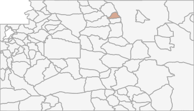
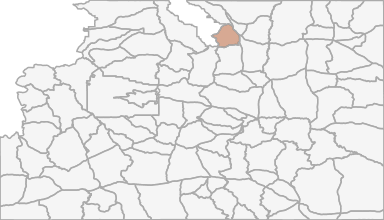
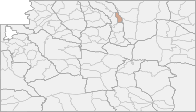
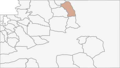
All Hunting in Wyoming Hunt Area 36 - Rock Creek
Beginning where Interstate Highway 90 crosses Piney Creek; southeasterly along said highway to Interstate Highway 25; southerly along said highway to French Creek east of the town of Buffalo; westerly up said creek to the North Fork Ditch; westerly up sai
Scores
Access Notes
Land Ownership
Legend
Beginning where Interstate Highway 90 crosses Piney Creek; southeasterly along said highway to Interstate Highway 25; southerly along said highway to French Creek east of the town of Buffalo; westerly up said creek to the North Fork Ditch; westerly up said ditch to the North Fork of Clear Creek; westerly up said creek to the divide along the Big Horn Mountain range; northerly along said divide to South Piney Creek; northeasterly down said creek to Piney Creek; easterly down said creek to Interstate Highway 90.
All Notes
HuntScore Tip
Only non‐Indian owned, fee title lands are open to the taking of wildlife with a Wyoming license. Land status is complicated and lawful access must be investigated thoroughly. Sportsmen are advised it is their responsibility to determine land status prior to entering these areas.
State Agency Website
Visit Wyoming Game & Fish DepartmentBusinesses Serving All Hunters In Hunt Area 36 - Rock Creek
Advertise Your Business!

Category: Guide/Outfitter
: 555-555-5555
About
Are you an outfitter, hunting guide, game processor or local hotel? Do you have landowner tags, lease land, or have an lodge? Advertise on HuntScore and reach hunters interested in this hunting unit! Send us an email at [email protected] to learn more. Read about advertising on huntscore here
Photos and Terrain Notes
Unit Elevation Profile
HuntScore generates thousands of synthetic hikes in the unit to create an elevation profile. This profile is what you can expect to experience within a 2 mile hike from a road or trail in this unit.
Elevation in this unit ranges from 4534' to 12431' with a median elevation of 5070'. If you are preparing to hunt this unit you should train for hiking up and down slopes of 5.3%.
This is typical incline or decline experienced while hiking from a road or trail in the unit
Common Elevation Profiles
All Harvest Stats (2021)
| Manner | Season | Type | Sex | Hunters | Harvest | Male | Female | Youth | Success Rate | Days Hunter |
|---|---|---|---|---|---|---|---|---|---|---|
|
A
|
9
|
LL
|
N/A | 46 | 12 |
12
|
0
|
0
|
26.1% | 8 |
|
A
|
9
|
LL
|
N/A | 46 | 12 |
12
|
0
|
0
|
26.1% | 8 |
|
ALL
|
ALL
|
ALL
|
N/A | 858 | 156 |
64
|
0
|
0
|
18.2% | 7 |
|
ALL
|
ALL
|
ALL
|
N/A | 858 | 156 |
64
|
0
|
0
|
18.2% | 7 |
|
F
|
NRS
|
N/A | 240 | 63 |
13
|
0
|
0
|
26.3% | 6 | |
|
F
|
NRS
|
N/A | 240 | 63 |
13
|
0
|
0
|
26.3% | 6 | |
|
F
|
RS
|
N/A | 618 | 93 |
51
|
0
|
0
|
15% | 7 | |
|
F
|
RS
|
N/A | 618 | 93 |
51
|
0
|
0
|
15% | 7 | |
|
F
|
4
|
LL
|
N/A | 217 | 54 |
0
|
0
|
0
|
24.9% | 6 |
|
F
|
4
|
LL
|
N/A | 217 | 54 |
0
|
0
|
0
|
24.9% | 6 |
|
F
|
6
|
LL
|
N/A | 214 | 38 |
0
|
0
|
0
|
17.8% | 6 |
|
F
|
6
|
LL
|
N/A | 214 | 38 |
0
|
0
|
0
|
17.8% | 6 |
|
F
|
G
|
|
N/A | 474 | 52 |
52
|
0
|
0
|
11% | 6 |
|
F
|
G
|
|
N/A | 474 | 52 |
52
|
0
|
0
|
11% | 6 |
Harvests Trends
Overall harvests trends are broken down by hunt_code, manner, season, sex, type, and species of deer (if applicable) to the extent state wildlife managers provide such data.
Total Harvest
Success Rate
Avg. Days Hunted
Weather Insights
Weather can vary by elevation. See how weather varies by elevation within a unit by selecting an elevation range. Elevation ranges are based on weather stations in or near the unit. Not all weather elements are available within the unit.
Average Temps
Use temperature ranges to plan and prepare for your hunt. Large swings indicate a good layering system should be used. Be sure to make note of the extreme temperatures as these often pose the greatest risk to hunters. If you plan on hunting in higher elevation, as a rule of thumb, expect the tempture to decrease roughly 5° for every 1000' in elevation gain.
WITH A FREE ACCOUNT GET:
- Precip totals by month
- Snow depth by month
- Min/Max precip and snow depth
- Average # of days between precip or snow event
- Wind speed and wind direction by month
- Sunshine and cloud cover stats by month
- Probability of other weather events (thunder, hail, etc...) by by month
Precipitation
The probability of precipitation is the likelihood of experience rain, snow, hail, etc... on a given day within the month. A good trick is to invert the probability to estimate how many days will pass, on average, between precipitation events. Hover or click a month to see how many days will pass between precipitation events.
Use the average and maximum precipitation events to set expetations for what rain gear to bring. Also remember that water availability can influence wildlife patterns, so be sure to check out the current weather patterns leading up to your hunt.
Snow
Each month of the year brings it's own challenges for weather. Select a month to see what you can expect and how to prepare for extreme events.
Likely Wind Directions
Wind Speed
Sunshine
Cloud Cover
Other Weather Events
Similar Nearby All Units
TrailHead Chatter
With A Free Account Get:
- Ability to read comments
- Ability to post comments
- Ability to upvote and downvote comments