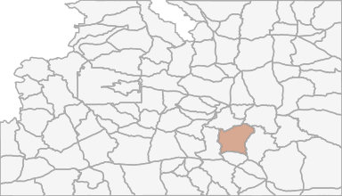
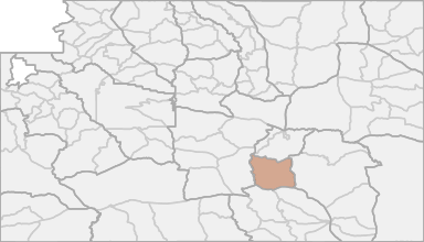
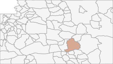
All Hunting in Wyoming Hunt Area 47 - Shirley Basin
Beginning at U.S. Highway 30 in the town of Medicine Bow; westerly along said highway to Wyoming Highway 72; northerly along said highway to the Hanna-Leo Road (Carbon County Road 291); northerly along said road to Troublesome Creek; northerly up said cre
Scores
Access Notes
With A Free Account Get:
- All Access Information
- Satallite and Topo Layers
- Public Landownership Layers
- Roads and Trails Layers
- Burn Layers
- Water Tank Layer (AZ Only)
Beginning at U.S. Highway 30 in the town of Medicine Bow; westerly along said highway to Wyoming Highway 72; northerly along said highway to the Hanna-Leo Road (Carbon County Road 291); northerly along said road to Troublesome Creek; northerly up said creek to the Troublesome Spring Road on Shirley Mountain; northerly along said road to the B.L.M. Fire Camp Road (B.L.M.Road 3115); northwesterly along said road to the Leo-Shirley Basin Road (Carbon County Road 102) at Pryor Flat; northeasterly along said road to the Dry Creek Road (Carbon County Road 103); northerly along said road to the Chalk Mountain Road (B.L.M. Road 3129); easterly along said road to Wyoming Highway 77; northerly along said highway to the Shirley Ridge Road (Carbon County Road 2), northeasterly along said road to the Lone Tree Road (B.L.M. Road 3141); northerly along said road to the Spring Creek Road; easterly along said road to the Bates Creek Road (Natrona County Road 402); northeasterly along said road to the Squaw Springs Trail Road; northerly along said road to U.S.F.S. Road 660; southeasterly along said road to the Little Medicine Road (Albany County Road 62); northeasterly along said road to the south boundary of the Laramie Peak Division of the Medicine Bow Forest; southerly and easterly along said boundary to Sheep Creek; southerly along said creek to its second crossing with the Marshall Road (Albany County Road 610); southerly along said road to U.S. Highway 30; westerly along said highway to the town of Medicine Bow.
All Notes
With A Free Account Get:
- Toggle between terrain, satellite, and topographic views
- Additional species-specific map layers
- Full screen maps
- Complete species hunting information
HuntScore Tip
All Wyoming antelope hunt areas are managed under a limited quota framework, meaning there are a set number of licenses valid for each specific hunt area. All hunt areas have full-price "any" antelope licenses (Type 0, 1, 2 or 9). Most hunt areas also provide reduced-price limited quota "doe/fawn" licenses (Type 6, 7 or 8), which can be obtained separately or in addition to a full-price license.
State Agency Website
Visit Wyoming Game & Fish DepartmentBusinesses Serving All Hunters In Hunt Area 47 - Shirley Basin
Advertise Your Business!

Category: Guide/Outfitter
: 555-555-5555
About
Are you an outfitter, hunting guide, game processor or local hotel? Do you have landowner tags, lease land, or have an lodge? Advertise on HuntScore and reach hunters interested in this hunting unit! Send us an email at [email protected] to learn more. Read about advertising on huntscore here
Photos and Terrain Notes
All Drawing Stats (2022)
1st Choice Draw Odds
| Stats | Apply For | Sex | Manner | Season | Type | Draw Odds | HuntScore | Notes |
|---|---|---|---|---|---|---|---|---|
| 047-6 |
F
|
ANY
|
G
|
LL
|
34.4%
|
77 | Doe or fawn | |
| 047-2 |
E
|
ANY
|
G
|
LL
|
64.2%
|
83 | Any antelope | |
| 047-1 |
E
|
ANY
|
G
|
LL
|
28.4%
|
78 | Any antelope |
Go Pro and get:
- Most up to date data!
- Drawing trends across multiple years
- Individual hunt quotas
- 1st choice license applications and licenses drawn
- Draw odds for resident and nonresident applicants
- Minimum preference points to draw
- Point creep plots
See all stats but the last 2 years with a free account!
All Harvest Stats (2021)
| Manner | Season | Type | Sex | Hunters | Harvest | Male | Female | Youth |
|---|---|---|---|---|---|---|---|---|
|
ALL
|
ALL
|
ALL
|
N/A | 940 | 892 |
627
|
265
|
0
|
|
ALL
|
ALL
|
ALL
|
N/A | 940 | 892 |
627
|
265
|
0
|
|
F
|
NRS
|
N/A | 213 | 207 |
148
|
59
|
0
|
|
|
F
|
NRS
|
N/A | 213 | 207 |
148
|
59
|
0
|
|
|
F
|
RS
|
N/A | 727 | 685 |
479
|
206
|
0
|
|
|
F
|
RS
|
N/A | 727 | 685 |
479
|
206
|
0
|
|
|
F
|
1
|
LL
|
N/A | 456 | 417 |
388
|
29
|
0
|
|
F
|
1
|
LL
|
N/A | 456 | 417 |
388
|
29
|
0
|
|
F
|
2
|
LL
|
N/A | 280 | 244 |
239
|
5
|
0
|
|
F
|
2
|
LL
|
N/A | 280 | 244 |
239
|
5
|
0
|
|
F
|
6
|
|
N/A | 290 | 231 |
0
|
231
|
0
|
|
F
|
6
|
|
N/A | 290 | 231 |
0
|
231
|
0
|
Go Pro and get:
- Most up to date data!
- Harvest trends across multiple years
- Harvest stats by hunt_code, manner, season, sex, type
- Average harvest rates
- Average days per hunter
- Overall harvest trends
See all stats but the last 2 years with a free account!
Weather Insights
Weather can vary by elevation. See how weather varies by elevation within a unit by selecting an elevation range. Elevation ranges are based on weather stations in or near the unit. Not all weather elements are available within the unit.
Average Temps
Use temperature ranges to plan and prepare for your hunt. Large swings indicate a good layering system should be used. Be sure to make note of the extreme temperatures as these often pose the greatest risk to hunters. If you plan on hunting in higher elevation, as a rule of thumb, expect the tempture to decrease roughly 5° for every 1000' in elevation gain.
WITH A FREE ACCOUNT GET:
- Precip totals by month
- Snow depth by month
- Min/Max precip and snow depth
- Average # of days between precip or snow event
- Wind speed and wind direction by month
- Sunshine and cloud cover stats by month
- Probability of other weather events (thunder, hail, etc...) by by month
Similar Nearby All Units
TrailHead Chatter
With A Free Account Get:
- Ability to read comments
- Ability to post comments
- Ability to upvote and downvote comments