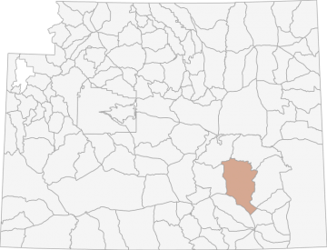
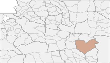
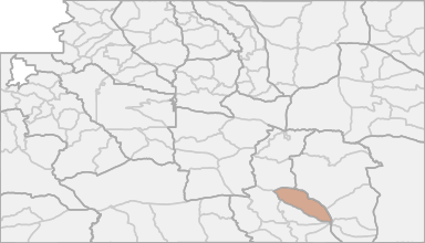
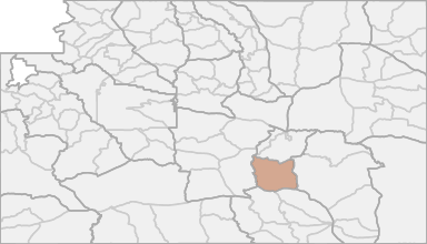
Deer Hunting in Wyoming Hunt Area 73 - Boswell
The season is designed to take advantage of high densities of white-tailed deer throughout southeast Wyoming as access allows. Hunt Area 161 was combined with Hunt Area 79 based on collar data from mule deer and to simplify the regulations.
Scores
Access Notes
With A Free Account Get:
- All Access Information
- Satallite and Topo Layers
- Public Landownership Layers
- Roads and Trails Layers
- Burn Layers
- Water Tank Layer (AZ Only)
Beginning at the junction of the Marshall Road (Albany County Road 610) and U.S. Highway 30 north of the town of Rock River; northwesterly along said highway to the junction with Wyoming Highway 487 at the town of Medicine Bow; northerly along said highway to the Lone Tree Road (B.L.M. Road 3141); northerly along said road to the Spring Creek Road; easterly along said road to the Bates Creek Road (Natrona County Road 402); northeasterly along said road to the Squaw Springs Trail Road; northeasterly along said road to U.S.F.S. Road 660; southeasterly along said road to the Cold Springs Road (Converse County Road 24); easterly along said road to the divide between the Little Medicine Bow River and LaPrele Creek; easterly along said divide to the divide between Corduroy Creek and Rocky Ford Creek; easterly along said divide to the Fetterman Road (Albany County Road 61); southerly along said road to U.S.F.S. Road 658; easterly along said road to South Fork Creek, a tributary to LaBonte Creek; southerly up said creek to the divide between Horseshoe Creek and the North Laramie River; southerly and easterly along said divide to the Esterbrook Road (Albany County Road 710); northeasterly along said road to U.S.F.S. Road 671; easterly and southerly along said road to the Bear Creek Road (Albany County Road 77); southwesterly along said road to the Garrett Road (Albany County Road 713); southeasterly along said road to the Dodge Ranch Road; southerly along said road to the Big Laramie River; southerly up said river to the Round Top-Flat Top Road at the steel bridge; southeasterly along said road to Wyoming Highway 34; southwesterly along said highway to U.S. Highway 30; northwesterly along said highway to the Marshall Road (Albany County Road 610).
Deer Notes
With A Free Account Get:
- Toggle between terrain, satellite, and topographic views
- Additional species-specific map layers
- Full screen maps
- Complete species hunting information
The season is designed to take advantage of high densities of white-tailed deer throughout southeast Wyoming as access allows. The majority of white-tailed deer are located on private land so the D... Create a free account to read the rest of this deer hunting note!
HuntScore Tip
Public land and private land percentages can sometime be misleading. A unit may have 80% public land, but a particluar species may only occupy 20% on the entire area. And that 20% species distribution may lie 100% within private lands. Does that sound confusing? Just remember that there are always exceptions to the rule, and land ownership is just one piece of the puzzle.
State Agency Website
Visit Wyoming Game & Fish DepartmentBusinesses Serving Deer Hunters In Hunt Area 73 - Boswell
Advertise Your Business!

Category: Guide/Outfitter
: 555-555-5555
About
Are you an outfitter, hunting guide, game processor or local hotel? Do you have landowner tags, lease land, or have an lodge? Advertise on HuntScore and reach hunters interested in this hunting unit! Send us an email at [email protected] to learn more. Read about advertising on huntscore here
Photos and Terrain Notes
Similar Nearby Deer Units
TrailHead Chatter
With A Free Account Get:
- Ability to read comments
- Ability to post comments
- Ability to upvote and downvote comments