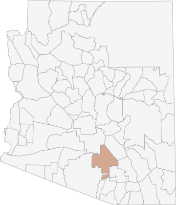
All Hunting in Arizona Game Management Unit 37A
Terrain varies from relatively flat desert plains to mesquite grasslands. The elevation in this area ranges from 1500 feet to 4000 feet. Vegetation is lower Sonoran desert scrub, primarialy creosote, rising to upper Sonoran desert grassland comprised of
Scores
Access Notes
With A Free Account Get:
- All Access Information
- Satallite and Topo Layers
- Public Landownership Layers
- Roads and Trails Layers
- Burn Layers
- Water Tank Layer (AZ Only)
Beginning at the junction of I-10 and Tangerine Rd. (Exit 240); southeast on I-10 to Avra Valley Rd. (Exit 242); west on Avra Valley Rd. to Sandario Rd.; south on Sandario Rd. to AZ Hwy 86; southwest on AZ Hwy 86 to the Tohono OÕodham (Papago) Indian Reservation boundary; north, east, and west along the reservation boundary to Battaglia Rd.; east on Battaglia Rd. to Toltec Rd.; north on Toltec Rd. to I-10 (Exit 203); southeast on I-10 to AZ Hwy 87 (Exit 211); north on AZ Hwy 87 to AZ Hwy 287; east on AZ Hwy 287 to AZ Hwy 79 at Florence; southeast on AZ Hwy 79 to its junction with AZ Hwy 77; south on AZ Hwy 77 to Tangerine Rd.; west on Tangerine Rd. to I-10.
All Notes
With A Free Account Get:
- Toggle between terrain, satellite, and topographic views
- Additional species-specific map layers
- Full screen maps
- Complete species hunting information
HuntScore Tip
Black bears, more than any other big game species in Arizona must be hunted early in the morning or late afternoon during the early fall hunts, if the hunter is to have an opportunity to locate the animals. Scouting prospective areas helps greatly and the use of binoculars and/or a spotting scope is almost mandatory.
State Agency Website
Visit Arizona Game and Fish DepartmentBusinesses Serving All Hunters In Game Management Unit 37A
Advertise Your Business!

Category: Guide/Outfitter
: 555-555-5555
About
Are you an outfitter, hunting guide, game processor or local hotel? Do you have landowner tags, lease land, or have an lodge? Advertise on HuntScore and reach hunters interested in this hunting unit! Send us an email at [email protected] to learn more. Read about advertising on huntscore here
Photos and Terrain Notes
Terrain varies from relatively flat desert plains to mesquite grasslands. The elevation in this area ranges from 1500 feet to 4000 feet. Vegetation is lower Sonoran desert scrub, primarialy creoso... Create a free account to read the rest of this terrain note!
All Drawing Stats (2023)
1st Choice Draw Odds
| Stats | Apply For | Sex | Manner | Season | Type | Draw Odds | HuntScore | Notes |
|---|---|---|---|---|---|---|---|---|
| 37A_J_1_E_HAM_S_LL |
E
|
HAM
|
S
|
LL
|
99.1%
|
0 | 2023 Hunt Code: 5080 | |
| 37A_J_1_E_ALL_S_LL |
E
|
ALL
|
S
|
LL
|
74.3%
|
0 | 2023 Hunt Code: 5031 | |
| 37A_J_1_E_ALL_S_Y |
E
|
ALL
|
S
|
Y
|
51.3%
|
0 | 2023 Hunt Code: 5044 | |
| 37A_J_1_E_A_S_LL |
E
|
A
|
S
|
LL
|
98.7%
|
0 | 2023 Hunt Code: 5094 |
Go Pro and get:
- Most up to date data!
- Drawing trends across multiple years
- Individual hunt quotas
- 1st choice license applications and licenses drawn
- Draw odds for resident and nonresident applicants
- Minimum preference points to draw
- Point creep plots
See all stats but the last 2 years with a free account!
All Harvest Stats (2021)
| Manner | Season | Type | Sex | Hunters | Harvest | Male | Female | Youth |
|---|---|---|---|---|---|---|---|---|
|
A
|
S
|
LL
|
E
|
1361 | 0 |
0
|
0
|
0
|
|
ALL
|
S
|
LL
|
E
|
717 | 0 |
0
|
0
|
0
|
|
ALL
|
S
|
Y
|
E
|
115 | 0 |
0
|
0
|
0
|
|
HAM
|
S
|
LL
|
E
|
326 | 0 |
0
|
0
|
0
|
Go Pro and get:
- Most up to date data!
- Harvest trends across multiple years
- Harvest stats by hunt_code, manner, season, sex, type
- Average harvest rates
- Average days per hunter
- Overall harvest trends
See all stats but the last 2 years with a free account!
Weather Insights
Weather can vary by elevation. See how weather varies by elevation within a unit by selecting an elevation range. Elevation ranges are based on weather stations in or near the unit. Not all weather elements are available within the unit.
Average Temps
Use temperature ranges to plan and prepare for your hunt. Large swings indicate a good layering system should be used. Be sure to make note of the extreme temperatures as these often pose the greatest risk to hunters. If you plan on hunting in higher elevation, as a rule of thumb, expect the tempture to decrease roughly 5° for every 1000' in elevation gain.
WITH A FREE ACCOUNT GET:
- Precip totals by month
- Snow depth by month
- Min/Max precip and snow depth
- Average # of days between precip or snow event
- Wind speed and wind direction by month
- Sunshine and cloud cover stats by month
- Probability of other weather events (thunder, hail, etc...) by by month
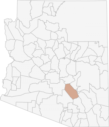
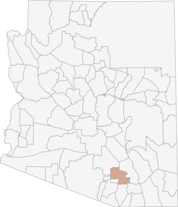
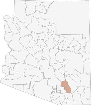
Similar Nearby All Units
TrailHead Chatter
With A Free Account Get:
- Ability to read comments
- Ability to post comments
- Ability to upvote and downvote comments