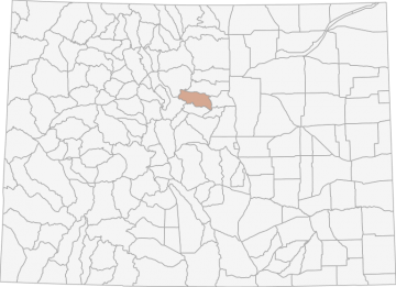
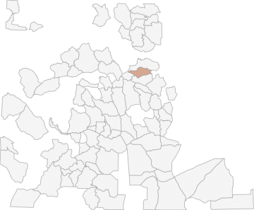
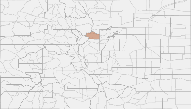
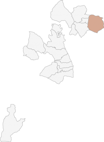
All Hunting in Colorado GMU 39 - Jefferson, Clear Creek, and Park Counties
The area ranges in elevation from about 5,100 feet in the east to over 14,000 feet in the west. The western part of the area is mountainous and includes many heavily forested areas, high alpine tundra, rocky outcroppings, shrubs, and open grasslands.
Scores
Access Notes
Land Ownership
Legend
Bounded on N by US Highway 40 and I-70; on E by County Highway 74 and Jefferson County Road 73; on S by US Highway 285, N Turkey Creek-Elk Creek divide and Pike-Arapaho National Forest boundary; on W by Continental Divide. (See unit 391.)
Reservation hunting takes place on Centennial Cone (Jefferson County Open Space) and Green Ranch (Colorado State Parks). Hunters using Highway 5 near Mt. Evans need to be aware there is no hunting ... Create a free account to read the rest of this access note!
All Notes
HuntScore Tip
Many units in pronghorn country are located on private land. However, many have been rated as good access locations. Landowners are more likely to give you permission to hunt pronghorn than deer.
State Agency Website
Visit Colorado Parks and WildlifeBusinesses Serving All Hunters In GMU 39 - Jefferson, Clear Creek, and Park Counties
Advertise Your Business!

Category: Guide/Outfitter
: 555-555-5555
About
Are you an outfitter, hunting guide, game processor or local hotel? Do you have landowner tags, lease land, or have an lodge? Advertise on HuntScore and reach hunters interested in this hunting unit! Send us an email at [email protected] to learn more. Read about advertising on huntscore here
Photos and Terrain Notes
The area ranges in elevation from about 5,100 feet in the east to over 14,000 feet in the west. The western part of the area is mountainous and includes many heavily forested areas, high alpine tun... Create a free account to read the rest of this terrain note!
Unit Elevation Profile
HuntScore generates thousands of synthetic hikes in the unit to create an elevation profile. This profile is what you can expect to experience within a 2 mile hike from a road or trail in this unit.
Elevation in this unit ranges from 6735' to 14196' with a median elevation of 8652'. If you are preparing to hunt this unit you should train for hiking up and down slopes of 12.6%.
This is typical incline or decline experienced while hiking from a road or trail in the unit
Common Elevation Profiles
All Over The Counter Hunts (2023)
| Residency | Species Deer | Sex | Manner | Season | Type | Dates | Notes |
|---|---|---|---|---|---|---|---|
|
RSNRS
|
|
E
|
A
|
U1
|
OTC
|
08/15/2023-09/20/2023, 08/15/2023-09/20/2023 | Permit Type A; License Valid for Units: 1, 7, 8, 9, 14, 15, 19, 20, 22, 23, 24, 25, 26, 29, 31, 32, 33, 34, 35, 36, 38, 39, 40, 42, 43, 44, 45, 46, 47, 51, 52, 53, 54, 59, 60, 61, 63, 64, 65, 69, 71, 72, 73, 74, 75, 76, 77, 78, 84, 85, 86, 89, 90, 91, 92, 93, 94, 95, 96, 97, 98, 99, 100, 101, 102, 104, 105, 106, 107, 109, 110, 111, 112, 113, 114, 115, 116, 117, 118, 119, 120, 121, 122, 123, 124, 125, 126, 127, 128, 129, 130, 132, 133, 134, 135, 136, 137, 138, 139, 140, 141, 142, 143, 144, 145, 146, 147, 191, 231, 361, 371, 421, 444, 461, 471, 511, 521, 591, 691, 711, 741, 751, 771, 851; except on Bosque del Oso SWA, 861 and 951; GMUs 39, 46: See -Land Closures & Use Restrictions,- page 68, for hunting closure details |
|
RSNRS
|
|
E
|
R
|
P5
|
OTC
|
09/02/2023-11/26/2023 | Permit Type C; License Valid for Units: 39, 46, 51, 104, 391, 461; private land only |
|
RSNRS
|
|
E
|
A
|
U1
|
OTCA
|
09/02/2023-09/30/2023 | Permit Type B; License Valid for Units: 39, 46, 51, 391, 461; 39, 46 See -Land Closures & Use Restrictions,- page 68. |
|
RSNRS
|
|
E
|
M
|
U1
|
OTCA
|
09/09/2023-09/17/2023 | Permit Type B; License Valid for Units: 39, 46, 51, 391, 461; 39, 46 See -Land Closures & Use Restrictions,- page 68 |
|
RSNRS
|
|
E
|
R
|
U5
|
OTC
|
10/14/2023-10/18/2023, 10/28/2023-11/05/2023, 11/11/2023-11/17/2023, 11/22/2023-11/26/2023 | Permit Type B; License Valid for Units: 39, 46, 51, 391, 461; 39, 46 See -Land Closures & Use Restrictions,- page 68.; 391, 461 Landowner permission is advisable before applying. Most land is private. |
All Harvest Stats (2022)
| Manner | Season | Type | Sex | Hunters | Harvest | Male | Female | Youth | Success Rate | Days Hunter |
|---|---|---|---|---|---|---|---|---|---|---|
|
SC
|
LL
|
N/A | 3 | 3 |
0
|
0
|
0
|
100% | 0 | |
|
ALL
|
LL
|
N/A | 6 | 4 |
3
|
1
|
0
|
67% | 0 | |
|
A
|
LL
|
N/A | 1 | 0 |
0
|
0
|
0
|
0% | 0 | |
|
A
|
A
|
|
E
|
0 | 0 |
0
|
0
|
0
|
4% | 0 |
|
A
|
A
|
|
N/A | 67 | 20 |
17
|
3
|
0
|
29% | 8 |
|
A
|
A
|
LL
|
N/A | 167 | 34 |
25
|
10
|
0
|
21% | 7 |
|
ALL
|
ALL
|
LL
|
N/A | 663 | 189 |
120
|
65
|
0
|
29% | 5 |
|
ALL
|
ALL
|
|
E
|
0 | 0 |
0
|
0
|
0
|
5% | 0 |
|
ALL
|
ALL
|
|
N/A | 414 | 136 |
90
|
43
|
0
|
33% | 7 |
|
AS
|
AS
|
|
E
|
0 | 0 |
0
|
0
|
0
|
6% | 0 |
|
CR
|
CR
|
|
E
|
0 | 0 |
0
|
0
|
0
|
1% | 0 |
|
M
|
M
|
|
E
|
0 | 0 |
0
|
0
|
0
|
2% | 0 |
|
M
|
M
|
LL
|
N/A | 104 | 25 |
20
|
5
|
0
|
24% | 5 |
|
M
|
M
|
|
N/A | 81 | 15 |
13
|
2
|
0
|
18% | 5 |
|
PX
|
PX
|
|
E
|
0 | 0 |
0
|
0
|
0
|
6% | 0 |
|
R
|
O4
|
LL
|
M
|
15 | 2 |
2
|
0
|
0
|
14% | 3 |
|
R
|
PLO
|
PLO
|
N/A | 70 | 32 |
0
|
31
|
0
|
46% | 17 |
|
R
|
PLO
|
PLO
|
N/A | 70 | 32 |
0
|
31
|
0
|
46% | 17 |
|
R
|
R
|
|
N/A | 265 | 101 |
61
|
38
|
0
|
38% | 7 |
|
R
|
R
|
LL
|
N/A | 2 | 1 |
0
|
0
|
0
|
50% | 0 |
|
R
|
R
|
|
E
|
0 | 0 |
0
|
0
|
0
|
7% | 0 |
|
R
|
O4
|
|
N/A | 15 | 2 |
2
|
0
|
0
|
14% | 3 |
|
R
|
R
|
LL
|
N/A | 392 | 130 |
75
|
51
|
0
|
33% | 4 |
|
R
|
O4
|
LL
|
N/A | 69 | 22 |
16
|
5
|
0
|
32% | 3 |
|
R
|
O2
|
LL
|
F
|
18 | 5 |
0
|
3
|
0
|
27% | 4 |
|
R
|
O3
|
|
N/A | 51 | 12 |
10
|
2
|
0
|
23% | 4 |
|
R
|
O3
|
LL
|
M
|
45 | 10 |
10
|
0
|
0
|
23% | 4 |
|
R
|
O3
|
LL
|
F
|
6 | 2 |
0
|
2
|
0
|
25% | 4 |
|
R
|
O3
|
LL
|
N/A | 89 | 39 |
33
|
6
|
0
|
44% | 3 |
|
R
|
O2
|
LL
|
N/A | 153 | 31 |
25
|
5
|
0
|
20% | 4 |
|
R
|
O2
|
LL
|
M
|
44 | 14 |
14
|
0
|
0
|
32% | 4 |
|
R
|
O1
|
|
N/A | 68 | 37 |
35
|
2
|
0
|
54% | 3 |
|
R
|
O1
|
LL
|
F
|
10 | 2 |
0
|
2
|
0
|
20% | 3 |
|
R
|
O1
|
LL
|
M
|
58 | 35 |
35
|
0
|
0
|
60% | 3 |
|
R
|
EL
|
LL
|
N/A | 81 | 39 |
0
|
34
|
0
|
48% | 6 |
|
R
|
O2
|
|
N/A | 62 | 19 |
14
|
3
|
0
|
30% | 4 |
Harvests Trends
Overall harvests trends are broken down by hunt_code, manner, season, sex, type, and species of deer (if applicable) to the extent state wildlife managers provide such data.
Total Harvest
Success Rate
Avg. Days Hunted
Weather Insights
Weather can vary by elevation. See how weather varies by elevation within a unit by selecting an elevation range. Elevation ranges are based on weather stations in or near the unit. Not all weather elements are available within the unit.
Average Temps
Use temperature ranges to plan and prepare for your hunt. Large swings indicate a good layering system should be used. Be sure to make note of the extreme temperatures as these often pose the greatest risk to hunters. If you plan on hunting in higher elevation, as a rule of thumb, expect the tempture to decrease roughly 5° for every 1000' in elevation gain.
WITH A FREE ACCOUNT GET:
- Precip totals by month
- Snow depth by month
- Min/Max precip and snow depth
- Average # of days between precip or snow event
- Wind speed and wind direction by month
- Sunshine and cloud cover stats by month
- Probability of other weather events (thunder, hail, etc...) by by month
Precipitation
The probability of precipitation is the likelihood of experience rain, snow, hail, etc... on a given day within the month. A good trick is to invert the probability to estimate how many days will pass, on average, between precipitation events. Hover or click a month to see how many days will pass between precipitation events.
Use the average and maximum precipitation events to set expetations for what rain gear to bring. Also remember that water availability can influence wildlife patterns, so be sure to check out the current weather patterns leading up to your hunt.
Snow
Each month of the year brings it's own challenges for weather. Select a month to see what you can expect and how to prepare for extreme events.
Likely Wind Directions
Wind Speed
Sunshine
Cloud Cover
Other Weather Events
Similar Nearby All Units
TrailHead Chatter
With A Free Account Get:
- Ability to read comments
- Ability to post comments
- Ability to upvote and downvote comments