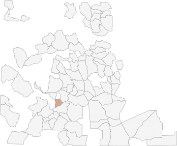
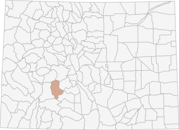
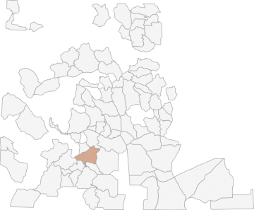
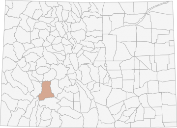
All Hunting in Colorado GMU S52 - Rock Creek
Those portions of Gunnison, Saguache and Hinsdale counties bounded on the north by BLM Roads 3035, 3036, (Cebolla Creek Road) 3047 (Huntsman Gulch Road) and 3043; on the east by USFS Road 806; on the south by USFS Road 788 (Los Pinos Pass Road), Saguache
Scores
Access Notes
With A Free Account Get:
- All Access Information
- Satallite and Topo Layers
- Public Landownership Layers
- Roads and Trails Layers
- Burn Layers
- Water Tank Layer (AZ Only)
Those portions of Gunnison, Saguache and Hinsdale counties bounded on the north by BLM Roads 3035, 3036, (Cebolla Creek Road) 3047 (Huntsman Gulch Road) and 3043; on the east by USFS Road 806; on the south by USFS Road 788 (Los Pinos Pass Road), Saguache County Road KK-14, Hinsdale County Roads 45, 15, and 5; and on the south and west by the Powderhorn Primitive Area boundary, USFS Trail 462, the East Fork of Powderhorn Creek, and Powderhorn Creek.
All Notes
With A Free Account Get:
- Toggle between terrain, satellite, and topographic views
- Additional species-specific map layers
- Full screen maps
- Complete species hunting information
HuntScore Tip
Public land and private land percentages can sometime be misleading. A unit may have 80% public land, but a particluar species may only occupy 20% on the entire area. And that 20% species distribution may lie 100% within private lands. Does that sound confusing? Just remember that there are always exceptions to the rule, and land ownership is just one piece of the puzzle.
State Agency Website
Visit Colorado Parks and WildlifeBusinesses Serving All Hunters In GMU S52 - Rock Creek
Advertise Your Business!

Category: Guide/Outfitter
: 555-555-5555
About
Are you an outfitter, hunting guide, game processor or local hotel? Do you have landowner tags, lease land, or have an lodge? Advertise on HuntScore and reach hunters interested in this hunting unit! Send us an email at [email protected] to learn more. Read about advertising on huntscore here
Photos and Terrain Notes
Similar Nearby All Units
TrailHead Chatter
With A Free Account Get:
- Ability to read comments
- Ability to post comments
- Ability to upvote and downvote comments